■Brief history of Tamagawa Josui Canal■
When Edo period started, the population of Edo started to increase rapidly and water shortage became a serious problem. The third Shogun Tokugawa Iemitsu decided to construct Tamagawa Josui to supply water from the Tama river. The construction started on 4th April, 1653.
It took 248days to complete the project. On 15th November, 1653, the first water from the Tama river went down the canal from Hamura to Yotsuya Okido. There is only ninety-two meters height difference between the two places and the Josui stretches forty three kilometers. (According to ”Josuiki, a traditional literature.")
Its large scale is often compared to Roman Aqueduct. Not only did the Josui provide enough water to the center of Edo/Tokyo at the beginning of modern period, divisions of water supplied sufficient water for a daily use and irrigation to the farmers in Musashino plateau.
In 1965, one third of the Canal stopped providing water. Still the Tamagawa Josui is a precious historical heritage of construction technology. Tamagawa Josui and the thickets along the Josui are an important element of the natural environment. Its value remains as precious as ever.
To conserve, preserve, and recover the Josui, the Tokyo government has designated it as a preservation area for its historical and environmental value in 1999. Also in 2003, it has been designated as one of the national cultural assets (historical remains).
■Tamagawa Brothers■
Tamagawa brothers (Tamagawa Shoemon and Tamagawa Seiemon) were spotlighted by the novel “Tamagawa brothers” written by Sonoko Sugimoto. The novel was published by Asahi Sinsya in 1974 and Tamagawa brothers became widely known across the country.
In the Edo period, they constructed the Tamagawa Josui canal to supply clean water to Edo (present Tokyo). However, their origins are yet unknown as the detailed record is missing.
Since the rapidly growing population in Edo has led to a water shortage, Ietsuna Tokugawa (the fourth Shogun) decided to build the Tamagawa Josui canal. He ordered its construction to Matsudaira Nobutsuna (one of the members of the shogun's council of elders) and Ina Tadaharu (representative of Kanto region). Matsudaira Nobutsuna was appointed as a grand magistrate to build the canal, while Ina Tadaharu as a waterworks magistrate who was responsible for constructing it on site.
Tamagawa brothers were chosen to build the canal and thus a historical water supply project began on 4th April 1653.
The brothers succeeded to make a canal of about 43 km long, starting from the Hamura intake weir by the Tama river and ending in Yotsuya Ohkido. The canal was completed on 20th June 1654 according to a Shogunate government diary. But, “Jyousui ki” (a record of the Tamagawa Josui canal) says it’s on 15th November 1653.
On the way of digging the canal, in Takaido (located in the present Suginami ward), the brothers ran out of the funds that were given by the Tokugawa Shogunate. But, they had to build the rest of the canal (about 1/3 of the entire canal) by all means to supply clear water to Edo. What they did was to spend their own money.
The Tokugawa Shogunate appreciated the brother’s great efforts and allowed them to use the surname “Tamagawa”, gave them 200 Koku (the unit of the amount of rice), and appointed them officers to maintain the Tamagawa Josui canal.
You can see the bronze stature of the brothers in the Hamurasekishita park in Hamura city where the canal starts. It was constructed in 1958 to praise their great achievement.
But, we know very little about the brothers. Some say that they could learn advanced civil engineering works started in Kansai region (centrally located in Japan) from their father who moved from the Kansai region to Edo. The others say that they were farmers living in an area along the Tama river, so they knew well the geographical characteristics of the Musashino plateau where the canal was built. Well, the brothers are still in mystery.
East Side of Takanodai Station
(Below is sample material we used during the English guide walk in 2016.)

①Usagibashi & Kousagibashi
There are two bridges over Shinbori water canal whose names include a Japanese word Usagi (hare): Usagibashi and Kousagibashi. It’s said that there were many hares in the area and people started to call the bridges with a word Usagi in their names.
There are two bridges over Shinbori water canal whose names include a Japanese word Usagi (hare): Usagibashi and Kousagibashi. It’s said that there were many hares in the area and people started to call the bridges with a word Usagi in their names.

Usagibashi

Kousagibashi
② Road Building Plan, named “Route Kodaira 3.2.8”
② Road Building Plan, named “Route Kodaira 3.2.8”
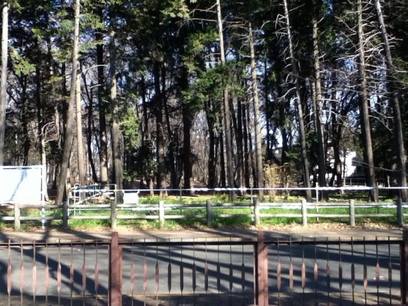
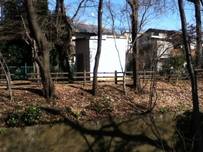
There is a road building plan named Route Kodaira 3.2.8, crossing Tamagawa Josui, and destroying the forest next to Kodaira Chuo Park.
Route Kodaira 3.2.8 is planned to have four lanes for cars, with the width of 36m. If the road is built, Tamagawa Josui would be divided by 36m road, and the half of the forest next to Kodaira Chuo Park and just at the north of Tamagawa Josui would be changed into the road. 481 trees in the forest and along Tamagawa Josui would be cut for building the road.
Tokyo Metropolitan Government plans to build the road by 2019, and now they are buying the land planned to become the road. They did the environmental assessment of the road building, with the conclusion saying, “there would not be so much bad effect to the environment.” Pictures in the environmental assessment show the scenery before and after building the road (almost the same!).
Tamagawa Josui is designated as a “Historical Monument” by a section of Japanese Government, Agency for Cultural Affairs. So Tokyo Metolopolitan Government needs to have a permission from the Agency to build the road crossing Tamagawa Josui. A citizens’ group in Kodaira, Midorino Tsunagari Shimin Kaigi is gathering signatures asking Agency for Cultural Affairs not to give the permission to Tokyo Government.
Precious Zokibayashi, which is likely to be lost forever due to road construction
③ Fureai Sewerage Museum (no picture)
The “Fureai Sewerage Museum” of Kodaira city is located about 100m to the south side of the Kyuemon bridge that crosses the Tamagawa Jousi canal.
In the museum, we can have an experience of getting into the sewerage pipe of 4.5m in diameter, that is actually used. The sewerage pipe is laid under the ground at the depth of 25m and runs right under the Fucyu Kaido road.
In 1970, Kodaira city started a public-works project to complete the sewerage system of the city, and, after about 20 years, in March 1991, the coverage rate of the sewerage system reached 100%.
To celebrate the completion of the project, in 6 October 1995, Kodaira city opened the “Fureai Sewerage Museum” and exhibited various materials to make visitors correctly understand about the sewerage system.
The exhibitions also include the pillar-type replica samples of the layer around the sewerage system and various explanations about the water environment in Kodaira city including irrigation canals in the city.
The exhibitions also include the pillar-type replica samples of the layer around the seweragesystem and the explanations about the water environment such as irrigation canals in Kodaira city.
④ Kyuemonbashi
This is an old bridge, whose name noted in 'Josui-ki,' a record of the canals in Edo period, was written in 1791.
It was a brick arch bridge built in 1932 and largely renovated in the All Tamagawa Josui Canal project in 1988. Its brick pier was still remained. The name 'Kyuemon-bashi' was said to come from the village headman, Kyuemon, but he is not identified.
According to the Josui-ki, there used to be a notice at the north of this bridge.
It said that the following acts were prohibited such as fishing, washing, mowing the grass on both sides of the canal for 3 ken(about 5.5 meters).
Whoever violated would become a criminal by the name of the magistrate.
This notice board, surrounded by a fence made of diagonally crossed bamboo sticks, disappeared in March 1836.
The maintenance of both of the notice and the fence was assigned to the village where it stood.
In the document of Ogawa family stated the detailed story on Kyuemon-bashi.
According to the documents of Ogawa and Nonaka family, there used to be a waterwheel on the Shinbori Yosui which run on the north of Kyuemon-bashi.
 The details such as the site and the date of the installation are unknown.
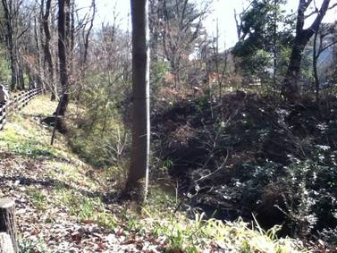
⑤ Two Years' Ship Traffic
There was a period when ships were used in the canal.
But it lasted only two years because the quality of water was damaged by ships.
It took about nine hours to go down from Hamura to Yotsuya Okido, and two or three days to go back.
To go upward, two workers pulled a ship with ropes.
The size of a ship was about 10 meters in length and 1.5 meters in width, which you can load a lot of goods, two tons, as heavy as 15 horses.
There was a stopping place near Kyuzaemonbashi, where the ship loaded and unloaded goods and passengers.
The place was restored, so you can’t see it anymore, but some poles are still buried there.
⑥ Branches of Tamagawa Josui
Tamagawa Josui stretches from west to east on the south of Musashino plateau and the water was delivered Tama area with its many branches.(diversions of the cannal).
Tamagawa Josui itself was about 43km long but its branches stretched through 400km.
The water of the branches was used for many purposes such as for drinking water, and for the filed of rice, wheat and vegetables. Because of these branches of the canal, many more new fields could be made.
Also people could use the power of water with waterwheels.
Here in Kodaira, there were about 40 waterwheels around 200 years ago.
The water of Tamagawa Josui was also used in the major paper factory at Oji(王子製紙)
in the Printing Beaurau of the Ministry of finance造幣局) and in the beer factory at Ebisu (ヱビスビール).
The number of branches had been gradually decreased and unified because of chronical water shortage and the water was repeatedly stolen.
⑦ Deadly Nerve Gas VX Found (no picture)
Do you believe that the dangerous VX nerve agent that could kill us was once buried along the bank of the Tamagawa Jousi canal?
It was Yasuo Hayashi , one of Aum Shinrikyo’s members who buried bottles contained VX nerve agent. He was arrested and confessed this fact in 1996.
The bottle was under a tree at the bank on the Tsuda college side.
Why at this place? It’s because his parents’ home was near from there and he knew this area.
We remember the heinous sarin attacks made by Aum Shinrikyo. Sarin was used to kill people in the Tokyo subway, and 12 people died and more than 5,000 people were injured. Since the chemical substance was used, those injured people must be still suffering from after effects.
The VX nerve agent is far more toxic than sarin.
What would happen if he didn’t tell the truth and the buried bottles were broken at the bank of the canal.
⑧ Water-resistant Sheets (no picture)
Once Tamagawa Josui didn't have water running for about twenty years, and the canal started to break down. So the people living near the canal appealed to the Tokyo government to run water again.
In 1986, they discharged water for a trial and found out there was a part that water was soaked into the ground in Tudamachi.
They paved the bottom with clay.
Also they spread water-resistant sheets in the bottom from around Takanodai station to Kamakurabashi. On August 7th, the canal had the first water after the long suspension.
⑨ Entrance to Underground Musashino Railway
In this small building, there is a hole to the underground Musashino Railway.
Under here, JR Musashino Line crosses Tamagawa Josui underground. The hole in this building is the way to the tunnel of Musashino Railway.
Water seeping to the Musashino railway tunnel is pumped up to the ground and drained through the pipe to Shinbori Yosui. Nowadays, the water seeping to the tunnel is very little, and we rarely see the water drained to Shinbori Yosui.
 ⑩ Kamakura Bridge
This bridge was built in 1977 for pedestrians and it was named Kamakura Bridge. It is said that the name might come from old Kamakura Highway which was running near here in Kamakura period. There is also a road called Kamakura Kaido on the north side of this bridge.
There were three main highways from Kamakura to far regions in around 13 century. At that time Shogun’s head quarter was at Kamakura in present Kanagawa prefecture, south of Tokyo. Those highways were very convenient for armies to move quickly between the capital and distant parts of the country. It’s exciting to imagine that samurai were walking around here in ancient times. We also can learn from historical records that once there was a bridge called Fuchu Bridge near this Bridge, but there is no trace of it now.
⑪ Ancient Highways : Tosando and Musashimichi (no picture)
Tosando highway was one of the seven highways which were connecting the capital of Japan and the provincial capitals. It was built around the year 658 and used until early 11 century.
Musashimichi road was a branch road of Tosando highway. It branched off from the main road at Nitta junction in Gunma prefecture, north of Tokyo, and it was once used as a main road between Nitta and Fuchu in present Tokyo.
The remaining tracks of Tosando(Musashimichi) highway was found in Kokubunji city in 1978. Kokubunji city is located at south of Kodaira city. 9 trench investigations were performed in Kodaira city to find the highway remnants at 3 sites. The ditches of the road were found and the hard surface of the highway was discovered as long as 18 meters
We can learn from those findings that Tosando highway was running across Tamagawajosui from south to north at the midpoint of Kamakura bridge and Komatsu bridge. The highway must have been decayed before the construction of the waterworks started. The remnants were probably excavated and removed at that time.
⑫ ⑬
⑭ Komatsubashi (no picture)
In 1954 a branch school of Kodaira first elementary school was built at the north side of the canal and it became Kodaira fourth elementary school in April 1956. Soon after Komatsubashi was made there in November 1956. It was the first wooded bridge over the canal, and now is the only bridge which is made of wood. The current one was renovated in July 1977.
Wood is used for all parts of the bridge; girder, floor, rail and mail pole. To keep the wooded bridge safe and strong, the floor and the rails are frequently renovated, but its wooden structure is preserved. The name of the bridge Komatsu, meaning small pines, is from the name of a place, Matsugaoka (a hill of pines), where there were many Japanese red pines.
⑮Boundary stones for Koganei Zakura (on the upper stream side of Tamagawa Josui canal) (no piture)
In October 1924, cherry trees that grow along the Tamagawa Josui canal were designated as National Scenic Beauty as “Koganei Sakura” or “Koganei cherry trees”. “Koganei Sakura” is located between the present Kodaira city and Koganei city, and it ranges about 9 km.
To identify the zone of “Koganei Sakura” , boundary stones were set along the banks of the canal. On the upper stream side, there are 4 boundary stones in total on Ogawa Suieijyo site; 2 (a set of old and new) boundary stones are on each bank. On the down stream side, the boundary stones were set at the upper steam side feet of the Sakai bridge in Musashino city.
The addresses of the designated zone at that time were as follows:
On the right bank: From 北多摩郡小平村大字鈴木新田字上1580 to 北多摩郡武蔵野村大字境字上水南1107.
On the left bank: From 北多摩郡小平村大字小川新田字上水内1175 to 北多摩郡武蔵野村大字関前字樋1280
Letters on the boundary stones (on the upper stream side):
The following Kanji characters are engraved in 4 faces of each boundary stone.
- Each of the new boundary stones (14 cm square column, 47 cm in height)
(1) 管理団体 東京都 (Management organization: Tokyo)
(2) 名勝境界 (Boundary of the scenic beauty)
(3) 名勝境界 (Boundary of the scenic beauty)
(4) 文化財保護委員会 (Cultural Properties Protection Committee)
- Each of the old boundary stones (15 cm square column, 28 cm in height)
(1) 東京都 (Tokyo)
(2) 名勝 (Scenic beauty)
(3) 文化財保護委員会 (Cultural Properties Protection Committee)
(4) 指定域境界 (Boundary of the designated zone)
Nowadays, the cherry trees in the designated zone are getting withered due to aging and environmental changes including increased urbanization. At first, in 1924, the number of the cherry trees was 1471, but it decreased to 1112 in 1992, and then to 849 in July 2014 according to the survey made by the Tokyo Metropolitan Board of Education.
Complementary planting of cherry trees started 5 years ago (2010).
⑯ 小川一丁目土地区画整備事業 (no picture)
We could see the Takeuchi family's huge Zelkova (keyaki) with typical rectangle-shaped field until 7 years ago.
This Zelkova is the first Natural Treasure of Kodaira city.
Several kinds of trees were planted around the farm houses in order to prevent them from the strong dust wind in spring, typhoons in fall and strong cold wind in winter.
Those trees were called 'kimori', windbreak trees forest.
Crops and vegetables' field were protected by tea plants as well.
We hope this scenery will remain in the future.
⑰⑱
⑲ Stone Monuments (no picture)
Three stones monuments, Ishibashi Kuyoutou, 申塔 and Batou Kannon, are closely situated in …, where old Itsukichi Kaido curves in a crank shape. They’re partly covered with Holly tree hedges and reminds us the long history of the old Kiado.
The right one is Ishibahi Kuyoutou made in 1844. Who built the monument is unknown, but it was built there to calm the spirits of people who lost their lives when the Ishibashi Bridge was washed away by a flood.
The middle one is … and it was built in 1801. The front is engraved with 青面金剛像. There are some names of old local communities engraved on both sides of the engraved Kongo figure. The left is Batou Kannon, built in 1875.
No comments:
Post a Comment